

Look for a
lock () or https:// as an added precaution. Share sensitive
information only on official, secure websites.
SLA announces new partnerships to harness space-based technologies and data to address climate challenges
· Inks Memorandum of Understanding with OSTIn to collaborate on an Earth Observation Initiative to catalyse the use of earth observation data to drive innovative solutions for sustainability and humanitarian goals across the Asia-Pacific region.
· Announces Memorandum of Understanding with NUS CRISP to leverage remote sensing data to enhance carbon biomass research, and expand mapping and land monitoring applications.
Singapore, 26 February 2025 – The Singapore Land Authority (SLA) today announced two strategic partnerships and key initiatives to harness space-based technologies and data to drive geo-enabled solutions to address climate mitigation and adaptation challenges.
2 As Singapore's national geospatial and mapping agency, SLA plays a pivotal role in the nation’s geospatial development and capability-building efforts. The new partnerships will broaden the use of space-for-earth technology and translate space-based data into actionable insights to support Singapore's goal of building a safe, sustainable, and smart city.
3 Two Memorandums of Understanding to mark the partnerships were signed at the sidelines of the Global Space Technology Convention and Exhibition 2025 (GSTCE 2025), organised by Singapore Space & Technology Limited (SSTL) and held at the Sands Expo and Convention Centre on 26 – 27 February 2025. Please refer to Annex A for the keynote address by Mr Colin Low, Chief Executive, SLA.
Growing Singapore’s space technology ecosystem
4 In line with Singapore's commitment to grow the local space technology ecosystem, SLA announced a collaboration with the Office for Space Technology and Industry (OSTIn), an office under the Economic Development Board (EDB), to jointly develop Singapore's space technology ecosystem, to support local and regional geospatial needs. An MOU was signed by Mr Colin Low, Chief Executive, SLA, and Mr Jonathan Hung, Executive Director, OSTIn.
5 This partnership leverages SLA's geospatial expertise and OSTIn's strengths in space technology for the newly launched Earth Observation Initiative (EOI). Together, both agencies will catalyse the use of earth observation data and enrich the Global Navigation Satellite System (GNSS) and remote sensing industry. This will translate to greater accuracy in tracking changes in coastlines, landscapes, streetscapes and vegetation over time, aid in advanced predictive analysis and forecasting the impact of climate change, and guide decision-making and solutioning for sustainability and humanitarian efforts in Singapore, and across the Asia-Pacific region. Please refer to Annex B for more details.
6 Mr Colin Low, Chief Executive, SLA, elaborates, “SLA’s strategic partnership with OSTIn on the Earth Observation Initiative marks a significant step in accelerating geo-enabled solutions to support Singapore’s sustainability agenda. Building on SLA’s experience in utilising space-based technologies and data for geospatial projects, the collaboration will drive innovative solutions and deepen regional cooperation to address challenges brought about by climate change.”
Leveraging geospatial technologies and data to improve environmental monitoring
7 In addition, SLA and the National University of Singapore Centre for Remote Imaging, Sensing and Processing (NUS CRISP) signed a Memorandum of Understanding (MOU) to collaborate on advancing research in remote sensing and geospatial applications. This partnership will leverage SLA’s 3D mapping data and CRISP’s expertise in satellite imaging to develop innovative solutions that support national mapping, carbon biomass research, and geospatial analytics. The MOU was signed by Dr Victor Khoo, Director, Survey & Geomatics, SLA, and Dr Lim Kim Hwa, Director, NUS CRISP.
8 Through this collaboration, SLA and NUS CRISP will work closely to explore the integration of LiDAR* data with remote sensing methodologies to enhance environmental monitoring and carbon biomass assessments with increased accuracy. The partnership will also focus on extending the use of Synthetic Aperture Radar (SAR) and InSAR** technologies to improve geospatial monitoring and mapping capabilities, including the tracking of mainland and coastal vertical land motion changes across the whole of Singapore, to enable effective coastal protection measures, flood-risk monitoring and efficient infrastructure planning. Please refer to Annex C for more details.
9 Dr Victor Khoo, Director, Survey & Geomatics, SLA, explains, “SLA is pleased to extend our partnership with NUS, through an inaugural collaboration with NUS CRISP, to harness geospatial technologies to enhance remote sensing and environmental monitoring capabilities. The collaboration underscores a shared commitment to push the boundaries of satellite remote sensing applications and uncover new opportunities for geospatial advancements, to support ongoing efforts to build more liveable and climate-resilient cities.”
*LiDAR – Stands for “light detection and ranging”, a technology that uses laser light to create a 3D representation of the earth’s surface.
**InSAR – Stands for “Interferometric Synthetic Aperture Radar” which uses radar images from orbiting satellites to map ground deformation and track volcanic activity.
10 SLA is also pleased to announce its partnership with Delft University of Technology to integrate space-based data to enhance the monitoring of land motion and sea-level rise across borders. This collaboration with Delft University of Technology includes the “3Sisters” project that has brought together geodetic expertise from Singapore, the Netherlands, and Indonesia, to develop new tracking systems such as the Dynamic Digital Elevation Model. Unlike static models, the dynamic model improves the prediction of long-term land motion and its impact on cross border coastal regions to help nations formulate best practices in climate change adaptation strategies.
International Geospatial Knowledge Sharing
11 To facilitate knowledge sharing, SLA will be organising a seminar ‘Mapping Earth from Space’, supported by SSTL. The seminar will delve into the realm of space-based geospatial technologies, including Global Navigation Satellite Systems (GNSS) and Earth Observation (EO), and explore their critical role in ensuring cities are safe, sustainable, and smart. Please refer to Annex D for more details.
12 For more details of GSTCE 2025, please refer here: Global Space Technology Convention & Exhibition (GSTCE) – Space Technology at the Centre of Igniting Innovation – for Space & for Earth
ANNEX A
Keynote Address by Mr Colin Low, Chief Executive, Singapore Land Authority at the Opening of Global Space Technology Convention & Exhibition 2025 at Sands Expo & Convention Centre, Marina Bay Sands, Singapore on 26 February 2025 (Wednesday)
Connecting Land and Space for a Safe, Sustainable, and Smart Singapore
Introduction
1. A very good morning to:
a) Deputy Prime Minister and Minister for Trade and Industry, Mr Gan Kim Yong;
b) Chairman, Singapore Space and Technology Ltd, Mr Jeremy Chan;
c) Distinguished guests, ladies, and gentlemen.
2. Welcome to the Global Space Technology Convention and Exhibition 2025. To all our international guests, thank you for joining us as we commemorate this milestone that Singapore is taking as we usher in a new era of growth for space technology and innovation.
Space-based Technologies and Freedom of Information
3. In the recent decades, space-based technologies have enabled the unprecedented freedom of access to information through Earth Observation. As highlighted in Deputy Prime Minister Gan’s speech, the growth and proliferation of space-based information has far-reaching implications for Singapore and the world. From enhancing our environmental monitoring capabilities to improving communication networks, satellite data is now instrumental in addressing various global challenges, including those related to climate change and sustainability.
4. The power of satellite imagery in crisis management and environmental monitoring is deeply impactful on a personal level. I'm sure many of us have seen satellite images of the devastation caused by disasters like the recent California wildfires or the earthquake that struck Hualien, Taiwan back in April. Being able to see for yourself the extent of these disasters and their impact on communities truly compels us to act swiftly and decisively to address the broader reaching impacts of climate change.
Partnerships and Collaborations
5. As we've heard from the speakers before us, the effective use of space-based technology requires strategic partnerships. In line with Singapore's commitment to growing our space technology ecosystem, I'm pleased to share that earlier today, SLA signed two new MOUs: one with the Office for Space Technology and Industry (OSTIn), and another with NUS's Centre for Remote Imaging, Sensing and Processing (CRISP).
6. SLA’s collaboration with OSTIn focuses on developing Singapore's space technology ecosystem, supporting local and regional geospatial needs. This partnership leverages SLA's geospatial expertise and OSTIn's strength in space technology, particularly through their newly launched Earth Observation Initiative. Together, we aim to catalyse the use of Earth observation data to support local and regional geospatial needs, while driving innovative solutions for sustainability and humanitarian efforts across the Asia-Pacific region.
7. To expand our insights into existing data, SLA’s partnership with CRISP aims to enhance existing research into carbon biomass estimation by sharing SLA’s LiDAR data acquired during our national mapping project. This collaboration facilitates the joint development and research of Synthetic Aperture Radar (SAR) for geospatial and mapping applications, paving the way for innovative technologies that will contribute to Singapore's vision of a safe, sustainable, and smart city.
8. Beyond these new partnerships, SLA continues to build on our existing international collaborations. Presently, we are working with Delft University of Technology to integrate space-based data to enhance geodetic infrastructure for monitoring land motion and sea-level rise. A part of this collaborative effort is the “3Sisters” project that aims to bring together geodetic expertise from Singapore, the Netherlands, and Indonesia, highlighting the importance of international collaboration for informed decision making and developing of climate change adaptation strategies.
A Safe, Sustainable, and Smart Singapore
9. As Singapore's national mapping and geospatial agency, SLA plays a pivotal role in harnessing space-for-earth technology. Our geospatial expertise is fundamental in translating space-based data into actionable insights that drive Singapore's goal of becoming a safe, sustainable, and smart city.
10. Since 2006, SLA oversees SiReNT, Singapore’s national positioning infrastructure. Today, SLA has ten reference stations, allowing us to provide users with precise and real-time positioning accuracies of up to three centimetres and a post-processed accuracy of five millimetres.
11. SLA is committed to maintaining, expanding and upgrading SiReNT. By collaborating with the Maritime and Port Authority of Singapore (MPA) and the Civil Aviation Authority of Singapore (CAAS), SLA is exploring to increase the number of SiReNT stations. This enhances the accuracy and reliability of data that goes into a wide range of applications like autonomous vehicle navigation, construction automation, and environmental and terrestrial monitoring.
12. SLA is also looking to collaborate with the Public Utilities Board (PUB), MPA, and the National Environment Agency’s Centre for Climate Research Singapore (CCRS) to combat sea level rise by integrating SiReNT data with SAR imagery for land motion monitoring at the millimetre-level. This aligns with our work with various United Nations technical groups and the International Hydrographic Organization on integrating terrestrial, maritime, and cadastral domains, showcasing our commitment to innovative sustainability solutions.
Capacity Building: The Geomatics Pipeline
13. As we advance geospatial technology, we must address a critical concern: the need for a robust geomatics pipeline to meet industry demand and tackle system vulnerabilities.
14. This need is highlighted by threats to space-based technologies, such as signal interference and jamming, which can disrupt critical GNSS-dependent sectors like aviation and emergency services. SLA is addressing these challenges by identifying interference sources, assessing impacts, and alerting users to potential disruptions. However, to truly enhance our resilience, we must prioritise capacity building in the geospatial field to develop expertise in managing these evolving threats
15. SLA, as Singapore’s leading geospatial agency, is committed to developing local talent in geomatics, geodesy, and space-based competencies. To foster the next generation of innovators and problem solvers, SLA, in collaboration with Singapore Space and Technology Limited (SSTL), organised the GNSS Innovation Quest (GIQ) that is specifically designed for tertiary and junior college students. The challenge encouraged participants to develop innovative solutions to real-world problems using SiReNT data. Winning projects of 2024’s iteration included autonomous delivery robots by Singapore Polytechnic students and a system for detecting invasive plant species in parks by NUS students, showcasing the versatility of SiReNT data across various sectors.
16. To strengthen the local geomatics pipeline, SLA is actively working to expand formal education pathways in this field. We're exploring the development of new tertiary education programmes specifically focused on geomatics. This initiative builds upon our existing collaborations with academic institutions like Singapore Polytechnic where we established the "SLA Geomatics Book Prize" for students in the Diploma of Civil Engineering programme. These efforts aim to create more structured and comprehensive educational opportunities in geomatics, enhancing our resilience in the face of vulnerabilities.
Closing
17. As we stand at the forefront of space-based technological advancements, the imperative for collaboration has never been more crucial. The challenges we face—from climate change to disaster management—are global in nature and require a unified approach.
18. I urge each of you to seize the networking opportunities available here. Engage in discussions, share your insights, and explore potential collaborations. It is through these connections that we can drive innovative solutions using space-based technology, pushing the boundaries of what's possible and addressing pressing global issues.
19. Let us leave this conference not just with new knowledge, but with new partnerships and a renewed commitment to harnessing the power of space technology for the betterment of our world.
20. I wish you all an enriching and exciting conference. Thank you.
ANNEX B
Memorandum of Understanding between Singapore Land Authority (SLA) and Office for Space Technology and Industry (OSTIn)

Mr Colin Low, Chief Executive, SLA (right), and Mr Jonathan Hung, Executive Director, OSTIn (left), signed a Memorandum of Understanding to jointly develop Singapore's space technology ecosystem, to support local and regional geospatial needs.
Quotes
“The partnership between OSTIn and SLA marks a significant step in leveraging Space Technology for national development. Tapping on SLA’s geospatial capabilities, we aim to enhance land management, environment monitoring and urban planning. This will also boost our efforts in areas such as the Earth Observation Initiative (EOI), where we will utilise space technologies to drive innovative solutions for real world issues. We look forward to working with like-minded partners as we harness satellite technology to drive innovation, sustainability, and resilience from Singapore.”
- Mr Jonathan Hung, Executive Director, OSTIn
“SLA’s strategic partnership with OSTIn on the Earth Observation Initiative marks a significant step in accelerating geo-enabled solutions to support Singapore’s sustainability agenda. Building on SLA’s experience in utilising space-based technologies and data for geospatial projects, the collaboration will drive innovative solutions and deepen regional cooperation to address challenges brought about by climate change.”
- Mr Colin Low, Chief Executive of SLA
ANNEX C
Memorandum of Understanding between Singapore Land Authority (SLA) and National University of Singapore Centre for Remote Imaging, Sensing and Processing (NUS CRISP)
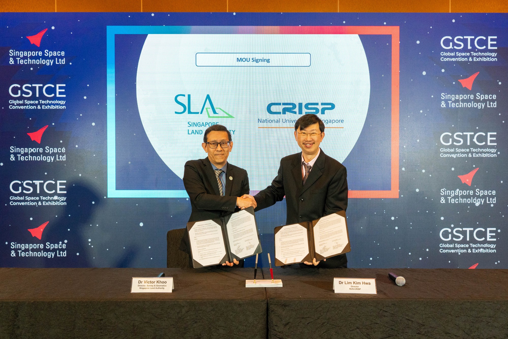
Dr Victor Khoo, Director, Survey & Geomatics, SLA (left), and Dr Lim Kim Hwa, Director, NUS CRISP (right), signed a Memorandum of Understanding to collaborate on advancing research in remote sensing and geospatial applications.
Quotes
“The collaboration between CRISP and SLA is a powerful step forward in geospatial research. By integrating SLA’s LiDAR data with CRISP’s remote sensing expertise, we can enhance national mapping, environmental monitoring, and urban planning. This partnership isn’t just about advancing technology—it’s about using data-driven insights to support sustainability and smarter urban development. True innovation happens when experts collaborate, exchange ideas, and push boundaries. I’m excited about the impact we can create together, shaping the future of remote sensing and geospatial science for a more sustainable Singapore.”
- Dr Lim Kim Hwa, Director, NUS CRISP
“SLA is pleased to extend our partnership with NUS, through an inaugural collaboration with NUS CRISP, to harness geospatial technologies to enhance remote sensing and environmental monitoring capabilities. The collaboration underscores a shared commitment to push the boundaries of satellite remote sensing applications and uncover new opportunities for geospatial advancements, to support ongoing efforts to build more liveable and climate-resilient cities.”
- Dr Victor Khoo, Director, Survey & Geomatics, SLA
ANNEX D
SLA Workshop – Mapping Earth from Space
26 February 2025, 2.00pm – 5.30pm
Venue: Begonia Jr Ballroom 3011, Sands Expo and Convention Centre, Marina Bay Sands.
Synopsis:
Organised by the Singapore Land Authority (SLA) and supported by the Singapore Space & Technology Ltd (SSTL), the seminar ‘Mapping Earth from Space’ will delve into the advanced realm of space-based geospatial technologies, including Global Navigation Satellite Systems (GNSS) and Earth Observation (EO), and explore their critical role in ensuring cities are safe, sustainable, and smart.
The seminar will highlight the synergistic relationship between space and geospatial domain. Discover how advancements in GNSS can enhance reliability and accuracy of geospatial applications, how Earth Observation can be used to analyse environmental and land changes and contribute to sustainable development. The seminar programme features six presentations and a panel discussion with experts in the field, discussing how GNSS interference treat, new applications of satellite imagery and SAR data, adoption of GEOAI and geoinformation modelling. Attendees will also gain valuable knowledge and insights on the latest development in positioning and mapping techniques from local and international speakers.
Workshop Programme
Time |
Agenda |
2.00pm – 2.05pm |
Welcome Remark Mr Sin Lye Chong, Assistant Chief Executive (Singapore Land Authority)
|
2.05pm – 2.10pm |
Welcome Remark Mr Thomas Zhuo, Executive Director (Singapore Space & Technology Ltd)
|
2.10pm – 2.30pm |
Presentation Integrated Monitoring of Land and Sea through Space-Based and Geodetic Techniques Mr Evert Mulder (Singapore Land Authority)
|
2.30pm – 2.50pm |
Presentation Geospatial Insights for Sustainable Cities: CoolNUS-BEAM Framework for Urban Microclimate and Greenery Insights Dr Marcel Ignatius
|
2.50pm – 3.10pm |
Presentation Building Building Damage Assessment with the Segment Anything Model from High-Resolution Optical Satellite Images. Ms Huang XiaoJing (Centre for Remote Imaging Sensing and Processing)
|
3.10pm – 3.30pm |
Presentation SAR Data and Solutions for Resilience and Sustainability Mr Vincent Kessler (Synspective) |
3.30pm – 3.50pm |
Break |
3.50pm – 4.10pm |
Presentation GNSS Signals Security Issues: Detection, Protection and Mitigation Dr Dinesh Manandhar (Tokyo University)
|
4.10pm – 4.30pm |
Presentation NMC’s Role in Strengthening National Timing, GNSS, and Earth Observation Resilience Through Backup Navigation and Timing Systems. Dr Meng Yusong (A*Star)
|
4.30pm – 5.30pm |
Panel Discussion Creating Safe, Sustainable, and Smart Cities: Integrating Space Technology for FutureUrban Developments.
Moderator: Dr. Victor Khoo from the Singapore Land Authority (SLA).
Panelists: – Mr. Satoshi Kogure from the Japan Aerospace Exploration Agency (JAXA) – Dr. Zhang Yan Liang from WESTON – Dr. Dinesh Manandhar from the University of Tokyo – Dr. Meng Yusong from the Agency for Science, Technology and Research (A*STAR) – Ms. Huang Xiaojing from the Centre for Remote Imaging, Sensing, and Processing (CRISP)
|
5.30pm |
End of Event |