A Singapore Government Agency Website


Secure websites use HTTPS
Look for a
lock () or https:// as an added precaution. Share sensitive
information only on official, secure websites.
X
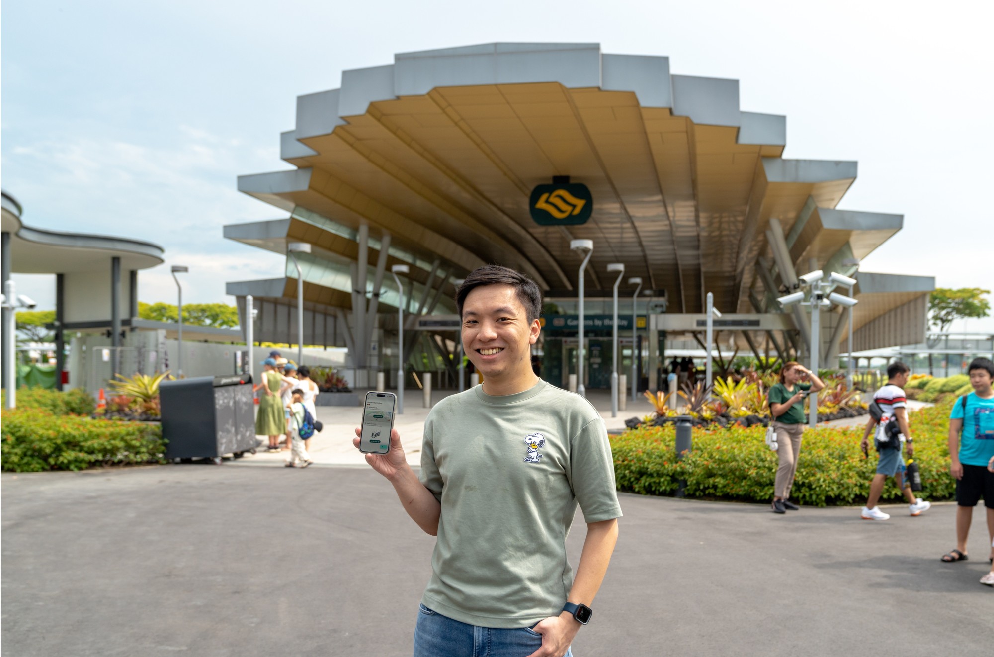
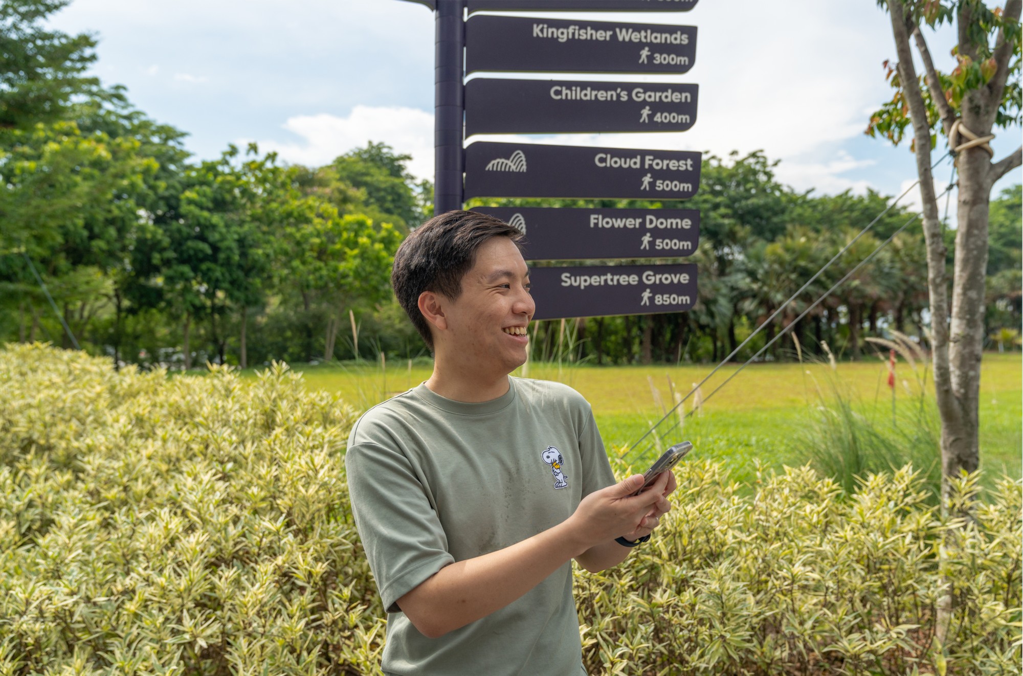
Geospatial Power! Next Station App
In the third instalment of our #GeospatialPower series, we roamed the MRT stations with Joshua Chua, a self-taught coder who has been leveraging SLA’s OneMap as the base map for his ‘Next Station’ app. Learn more about his app, which has seen 16,000 downloads since its launch in April 2024 and how it has been enhancing the daily MRT commutes of Singaporeans.
Hi Joshua, congrats on launching your “Next Station” app earlier this year! How did you come up with the idea of mapping MRT stations and their exits?
The MRT is where the action is—tons of people use it daily, and I wanted to make a real impact. Plus, I knew this was a project I could handle and maintain by myself in the long run. Also, I wanted to identify unmet commuter needs that existing apps on the market were not addressing. The idea just clicked!
Tell us some of the app’s interesting features.
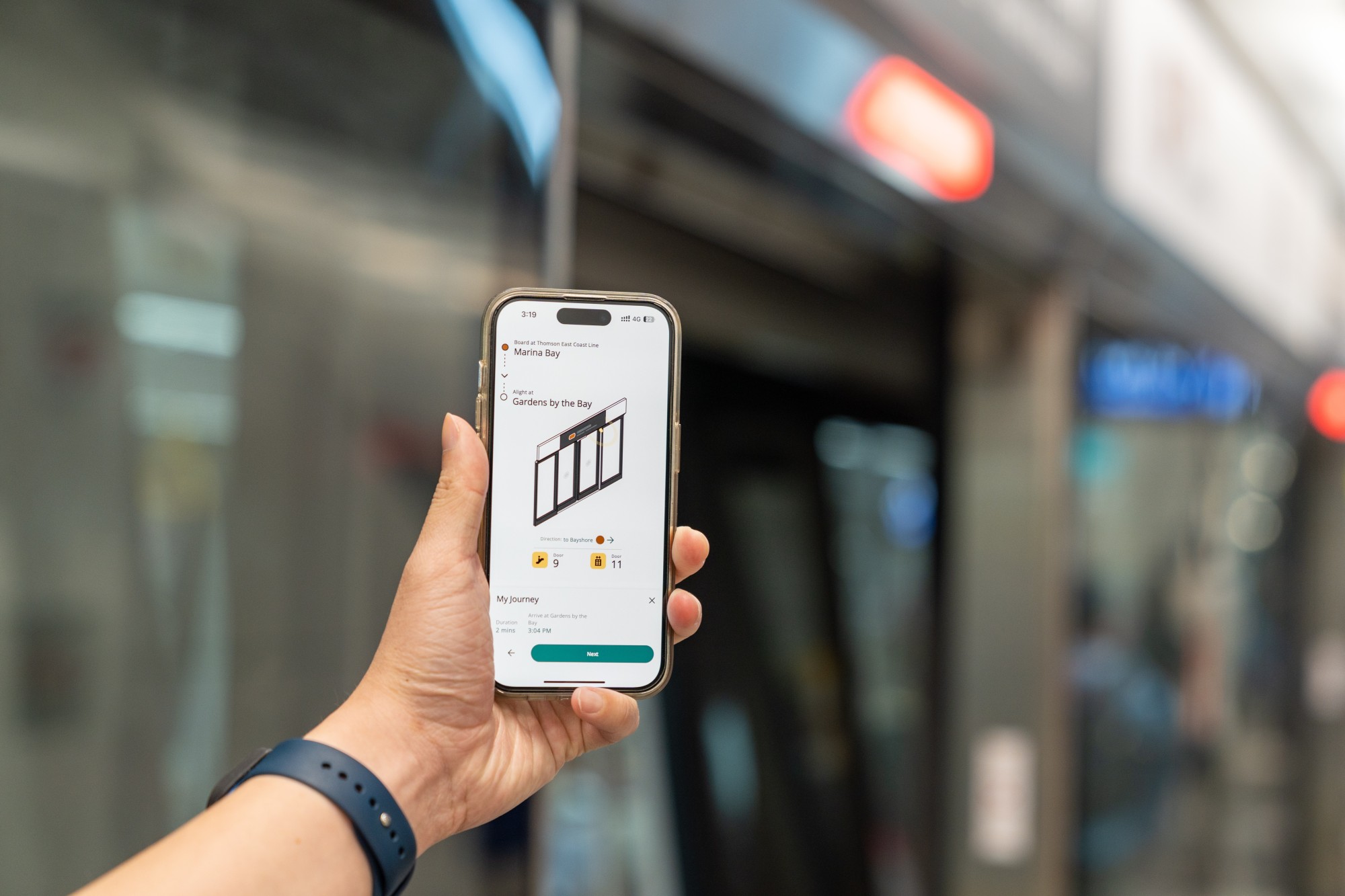
In a nutshell, ‘Next Station’ is a start-to-end MRT journey planning app that helps with 3 main points:
- Before your journey, providing multiple route options from station A to B
- During your journey, giving station-by-station door instructions
- When you alight, offering a one-tap exit map to get to your destination
I also tackled a common issue among commuters who love to eat supper late at night but still want to take the MRT back home. The app ensures that users know the minimum time left before they miss the last train on any part of their journey, including LRT lines. This removes the guesswork for commuters when they are unsure if they can catch the last train during transfers.
You use SLA’s OneMap as the base map for your app. How did you know about OneMap?
I knew about OneMap from my time in the public sector and while browsing data.gov.sg. Initially, I tried other commercial mapping solutions, but they were either too expensive or too restrictive. When I plugged OneMap into my app, it just worked! OneMap has been the backbone of my app ever since.
How has OneMap helped in the development of your app?
OneMap has been a game-changer for ‘Next Station’. Its up-to-date, localised information is crucial for mapping new or changing environments, like the ongoing BTO construction near Canberra MRT and even new districts such as Tengah. This level of detail gave me the confidence to implement features like the nearby exit function, where I can mark tappable areas on the map and trust OneMap to keep up with new buildings, roads, and landmarks—something international mapping platforms often lack due to missing local context.
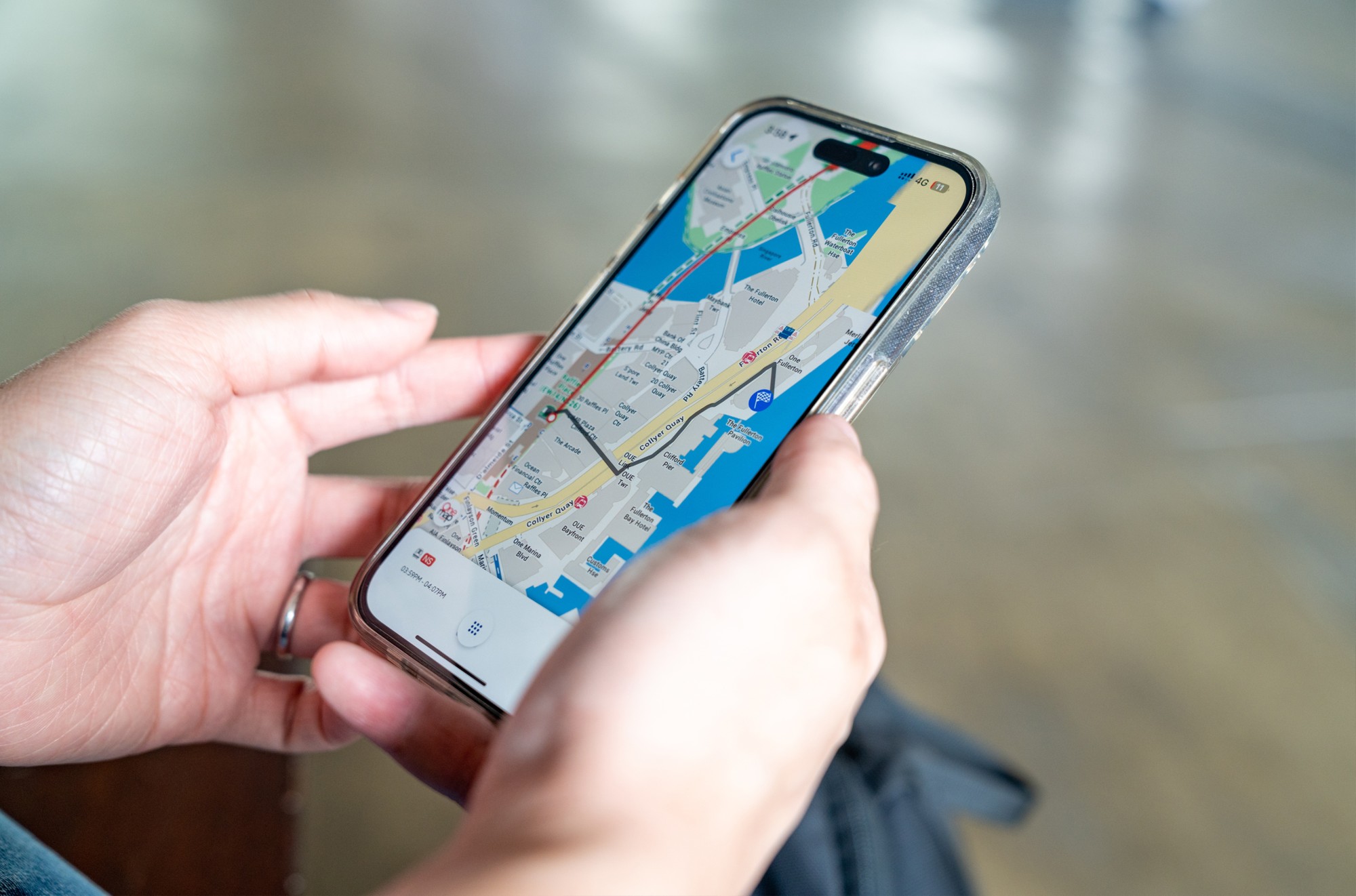
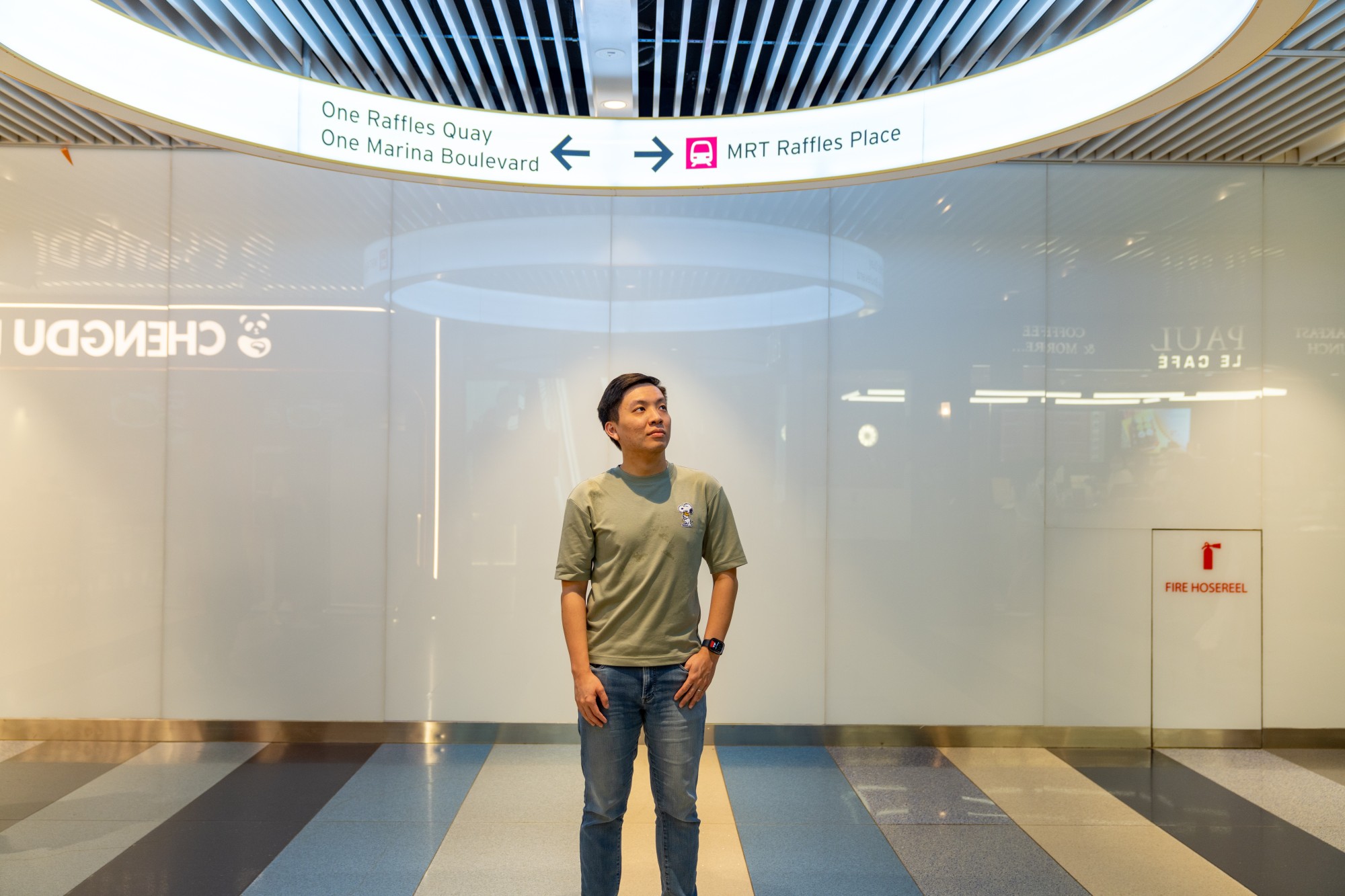
Take for example the route from Raffles Place MRT station to One Fullerton. While other maps might suggest Exit B based on satellite views, a localised map would know Exit A is better because it has an air-conditioned overhead bridge that makes crossing easier. It’s not just about distance; it’s about which route is more walkable and pedestrian-friendly. That’s the kind of local knowledge OneMap provides, which I rely on heavily to develop the app.
OneMap also plays a crucial role in future planning. With developments like the upcoming Punggol Coast Station, OneMap already reflects these changes, allowing me to update the app’s exits and features smoothly.
Is there anything you wish OneMap could provide to make things easier for you?
Is there anything you wish OneMap could provide to make things easier for you?
Map customisation would be incredibly helpful from a UX design standpoint. If I could make OneMap visually integrate into any app style or toggle off building, road, or landmark labels, it would allow me to simplify the nearby exit feature. This way, I could overlay my own animated labels and show only the necessary information for users' navigation needs.
What kind of challenges did you face when developing and mapping?
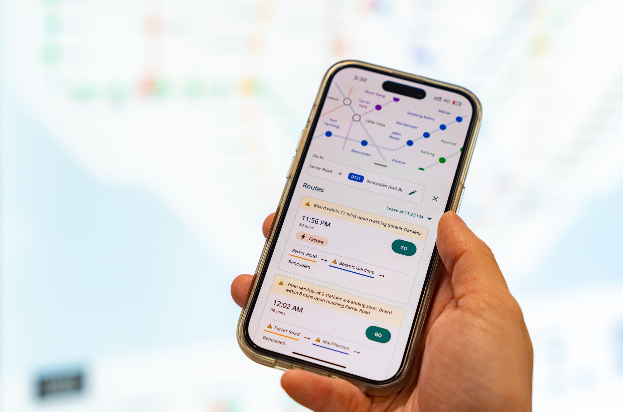
One challenge was designing the algorithms to offer multiple routes—fastest, least transfers, most direct—and rank them by travel time. Every time a user requests a route on the app, four different server algorithms work together to offer transit options.
Then, there’s the user experience. For example, instead of overwhelming users with a table of first and last train timings for each station, I simplified it to just the last train time, with a warning if the service is ending soon. It’s all about making the app intuitive and user-friendly.
Which station was the most challenging to map?
Shenton Way MRT was particularly challenging due to its multi-level, crisscrossing escalators. Even after physically visiting the station, it took several attempts to fully understand its layout. HarbourFront MRT on the North-East line also posed challenges, particularly in mapping the "flipped" door numbers at terminus stations. In these cases, the local insights provided by OneMap were invaluable, as they offered the depth needed to correctly inform users.
Shenton Way MRT was particularly challenging due to its multi-level, crisscrossing escalators. Even after physically visiting the station, it took several attempts to fully understand its layout. HarbourFront MRT on the North-East line also posed challenges, particularly in mapping the "flipped" door numbers at terminus stations. In these cases, the local insights provided by OneMap were invaluable, as they offered the depth needed to correctly inform users.
Are there any new features you are adding to the app with OneMap?
Users often know the name of the place they want to go but aren’t sure where it is on the map. This feature has been highly requested. As of now, users can’t search for building names, but that’s something I am considering adding to the app with the help of OneMap.
However, adding such a feature requires careful planning to avoid overwhelming users. It’s a balance I am trying to strike while scoping out new functionalities.
What do you envision the app to be?
I want “Next Station” to be the go-to app for MRT commuters, eliminating the need for repeated Google searches or standing in front of locality and system maps. The dream is to make it so simple and natural to use that it becomes second nature. I’m even thinking about expanding it overseas, maybe to Malaysia. But for now, my focus is on making this app as effective and helpful as possible. If I can shave 30 minutes off someone’s daily commute, that’s a win!
Do you have a favourite station?
Punggol Coast Station is my favourite, primarily because of its unique location near the sea, its integration into the new digital district, and how it’s being built directly into surrounding structures. It’s going to feel different from other stations - I can’t wait to see how it all comes together. I also like Gardens by the Bay, for its aesthetic design and because it’s where my wife and I used to go for our first few dates. Now we can easily take the MRT back home from there!
SLA’s #GeospatialPower series highlights individuals and companies utilising SLA’s #geospatial data, technology, and infrastructure to create innovative solutions for a smarter, safer, and more sustainable Singapore.